7.7-Magnitude Earthquake Strikes Indonesia, At Least 47 Dead
World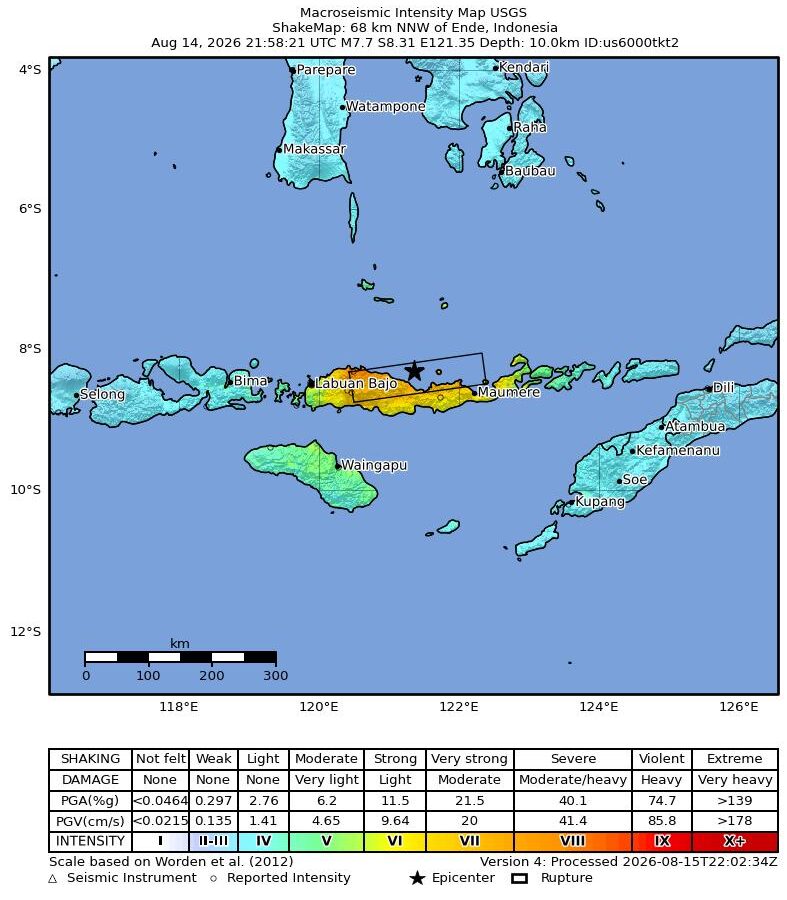
August 15, 2026. Indonesia.
A major earthquake measuring 7.7 in magnitude struck near the northern coast of Flores Island, East Nusa Tenggara province, Indonesia, at 5:58 a.m. on August 15. According to the U.S. Geological Survey (USGS), the epicenter was located about 68 kilometers northwest of Ende town, at a depth of around 10 kilometers, caused by a shallow reverse (thrust) fault beneath the Flores Sea.
At least 47 people have died so far, with more injured. Indonesia’s Agency for Meteorology, Climatology and Geophysics (BMKG) issued a tsunami warning for potentially affected coastlines, which was later lifted. USGS reported more than ten aftershocks ranging from magnitude 4.5 to 6.1.
Indonesia sits within the highly earthquake-prone “Ring of Fire,” so powerful earthquakes like this one occur there periodically. Rescue operations are continuing, and the death toll is expected to rise further.
(Sources — USGS, Al Jazeera, NBC News)
NIYO Media takes accuracy seriously. If you find anything wrong in this story, tell us about it - we will check it and put it right.