Worst Wildfires of the Year Scorch Europe, Seen in NASA Satellite Images
World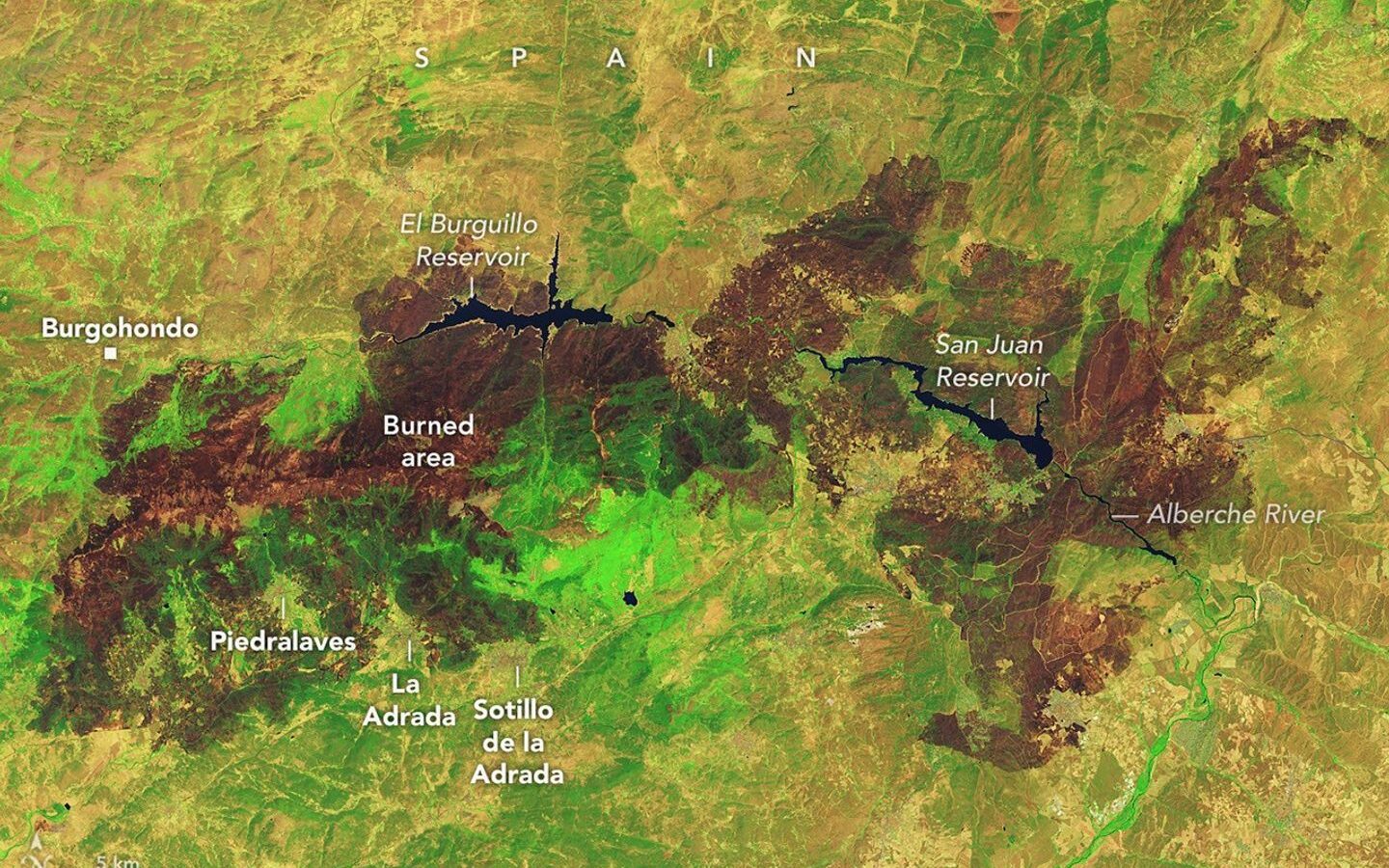
Wildfires have burned across western Europe in rapid succession since July 2026, becoming the largest and most disruptive fires Spain and France have faced in decades. The largest blazes broke out in mid-July in France’s Gironde department in the southwest, and in Spain’s Ávila and Madrid provinces.
By early August, air quality had dropped to levels hazardous to health because of the fires, hundreds of buildings were destroyed, and residents were forced to evacuate. Europe was hit by three separate heat waves between late June and early July, which the World Weather Attribution research group identified as the most intense on record for the region, directly linked to human-caused climate change.
NASA’s Landsat 9 satellite captured a large burning area surrounding the El Burguillo and San Juan reservoirs in the mountains west of Madrid on July 29. The false-color imagery clearly distinguishes already-burned areas, shown in brown, from areas still green with vegetation.
(Sources — NASA Earth Observatory, ScienceDaily, ESA)
NIYO Media takes accuracy seriously. If you find anything wrong in this story, tell us about it - we will check it and put it right.